
Mobile SLAM Scanning Services
For Rapid Indoor Reality Capture & Digital Twin Creation
Fast, Efficient Reality Capture for Large Buildings, Factories, Campuses & Infrastructure
Mobile SLAM (Simultaneous Localization and Mapping) revolutionizes Reality Capture by allowing engineers to walk naturally through a facility while continuously capturing millions of 3D measurements in real time.
WildplantTS provides professional Mobile SLAM Scanning Services for commercial buildings, industrial facilities, manufacturing plants, airports, hospitals, universities, warehouses, infrastructure, and smart campuses.
What is Mobile SLAM?
Mobile SLAM (Simultaneous Localization and Mapping) is an advanced Reality Capture technology that combines:
to continuously determine the scanner's position while simultaneously mapping the surrounding environment.
Unlike traditional terrestrial laser scanners that require multiple static setups, Mobile SLAM allows operators to simply walk through a facility while the system captures the environment continuously.
The result is a highly accurate 3D point cloud generated in a fraction of the time.
Why Choose Mobile SLAM?
Extremely Fast Data Capture
Capture thousands of square metres within minutes instead of hours.
Minimal Operational Disruption
Most facilities remain operational during scanning, minimizing downtime.
Perfect for Large Indoor Facilities
Ideal for documenting warehouses, airports, hospitals, campuses, shopping centres, factories, and industrial plants.
Reduced Site Visits
Capture complete facilities in one visit with fewer setup requirements.
Digital Twin Ready
Generate engineering-ready point clouds that support BIM, GIS, CAD, and Digital Twin workflows.
Our Mobile SLAM Workflow

Project Planning

Site Assessment

Mobile SLAM
Reality Capture

Trajectory
Processing
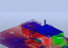
Point Cloud
Optimization

Quality Assurance

Engineering
Processing

CAD / BIM /
Digital Twin

Project Delivery
Technologies We Use
Our Mobile SLAM workflows combine:

High-
Performance
LiDAR Sensors

Advanced
SLAM
Algorithms

IMU
Navigation

Colour
Imaging

Trajectory
Optimization

Point Cloud
Processing

Cloud
Registration
Industries We Serve

Manufacturing

Warehousing

Logistics

Commercial
Real Estate

Healthcare

Education

Airports

Government

Utilities

Hospitality

Industrial Facilities

Smart Cities

Infrastructure

Facility
Management
Engineering Deliverables

Registered
Point Clouds
Professionally processed point clouds optimized for engineering applications.
Supported Formats:
- E57
- RCS
- LAS
- PTS
- LAZ
- XYZ
- RCP
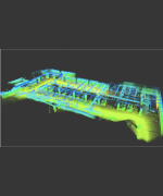
Indoor Mapping
Generate accurate digital indoor maps.
Applications include:
- Facility Navigation
- Emergency Planning
- Indoor GIS
- Space Management
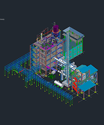
CAD
Deliverables
Produce:
- Floor Plans
- Building Layouts
- General Arrangement Drawings
- Existing Conditions Drawings

BIM Models
Convert point clouds into intelligent Building Information Models.
Deliverables include:
- Revit Models
- IFC Models
- LOD Models
- Architectural BIM
- Facility BIM

Asset Registers
Digitally document:
- Equipment
- Rooms
- Utilities
- Infrastructure Assets
- QR Asset Databases

Facility Digital
Twins
Develop Digital Twins supporting:
- Facility Management
- Maintenance
- Asset Intelligence
- Space Optimization
- Remote Collaboration
Additional Deliverables

Panoramic Images

As-Built
Documentation

GIS Layers

Indoor GIS
Models

Construction
Verification

Existing Conditions
Reports
Benefits of Mobile SLAM
Faster Project Completion

Lower Operational Impact

Efficient Large-Area Coverage

Engineering-Ready Outputs

Cost-Effective Reality Capture

Supports Smart Facilities

Mobile SLAM vs Other Technologies
| TECHNOLOGY | BEST APPLICATION |
|---|---|
| Mobile SLAM | Large indoor facilities requiring rapid capture |
| Terrestrial LiDAR | Projects requiring the highest geometric accuracy |
| Drone LiDAR | Large outdoor environments and corridors |
| Drone Photogrammetry | Visual mapping and construction progress |
Why Choose WildPlantTS?

Reality Capture Experts
We recommend the most suitable technology rather than a one-size-fits-all solution.

Multi-Technology Capability
Many projects combine Mobile SLAM with Terrestrial LiDAR and Drone LiDAR to balance speed, coverage, and accuracy.

End-to-End Engineering
Services
We deliver Reality Capture, Point Cloud Processing, Scan to CAD, Scan to BIM, GIS integration, and Digital Twin development.

Nationwide & Global Support
We provide Mobile SLAM scanning services across India and engineering deliverables for international clients.
Related Services

Terrestrial LiDAR
Scanning

3D Laser
Scanning
Services

Existing
Conditions
Survey

Building
Scanning

Factory
Scanning

Scan to CAD

Scan to BIM

Point Cloud
Processing

Digital Twin
Development
Related Industries

Terrestrial LiDAR

Drone LiDAR

Drone
Photogrammetry

Point Cloud
Technology

Indoor GIS

Asset Intelligence

Reality Cloud
Ready to Digitize Your Facility Faster?
Whether you're documenting a warehouse, airport, hospital, manufacturing plant, university campus, or commercial building, WildPlantTS delivers Mobile SLAM Scanning services that provide fast, accurate, and engineering-ready Reality Capture for your next project.
Frequently Asked Questions
1. When should Mobile SLAM be used instead of Terrestrial LiDAR?
Mobile SLAM is ideal when rapid capture of large indoor environments is the priority. For projects requiring the highest engineering accuracy, terrestrial LiDAR may be more appropriate, or both technologies can be combined.
2. Can Mobile SLAM data be converted into BIM?
Yes. In many cases, scanning can be performed with minimal interruption to production, following your site's safety and operational requirements.
3. Can you create BIM and CAD models from the scan?
Yes. We convert Mobile SLAM point clouds into Revit models, IFC models, CAD drawings, Facility Models, and Digital Twins.
4. Does Mobile SLAM work without GPS?
Yes. SLAM technology is specifically designed to operate indoors where GPS signals are unavailable.
5. Can operational facilities be scanned?
Yes. Most factories, hospitals, warehouses, airports, and commercial buildings can be scanned while remaining operational, subject to safety and access requirements.
6. Is Mobile SLAM suitable for Digital Twin projects?
Absolutely. Mobile SLAM provides a fast and efficient way to capture the spatial data required for Building, Factory, Campus, and Facility Digital Twins.