
Stockpile Analysis Services
Accurate Volume. Actionable Insights.
Terrestrial LiDAR & SLAM Powered.
WildplantTS Offers High-precision stockpile volume measurement, inventory tracking, and material reconciliation using advanced terrestrial LiDAR scanners and handheld SLAM systems.
Our Scanning Technologies
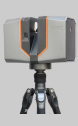
EPIC T150
Long-Range Terrestrial LiDAR
- Up to 150 m Range
- 19M pts/sec
- High Accuracy & Speed
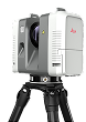
Leica RTC360
Terrestrial Laser Scanner
- 2 Million pts/sec
- 360° × 300° Field of View
- Trusted Accuracy
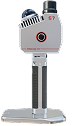
Precise S7 SLAM
Handheld Mobile Scanner
- Real-time Mapping
- No GPS Required
- Agile & Adaptive
Our Terrestrial & SLAM Technologies
EPIC T150
LONG-RANGE TERRESTRIAL LiDAR

- Long range up to 150 m
- High speed 19M pts/sec
- High accuracy even on low reflectivity surfaces
- Ideal for large stockpiles and open areas
LEICA RTC360
TERRESTRIAL LASER SCANNER

- Fast & accurate data capture
- 2 Million points per second
- 360° × 300° wide field of view
- Compact, robust and easy to deploy
PRECISE S7 SLAM
HANDHELD MOBILE SCANNER

- Agile, flexible and accurate
- Real-time point cloud mapping
- Works in GPS denied environments
- Perfect for inaccessible areas
Why Choose Terrestrial LiDAR & SLAM
Terrestrial & SLAM Survey
- No DGCA Permissions
- Works in Dust & Low Visibility
- Works in Any Weather
- High Accuracy & Point Density
- Safe Long-Distance Scanning
- No Flight Planning
- Continuous Operations
- Higher Repeatability

Drone Based Survey
- Affected by Weather
- Limited by Flight Time
- Needs Permissions
- Wind Affects Accuracy
- Limited Payload
- Safety & Legal Risk
- Lower Surface Density
Our Stockpile Analysis Workflow
RTC360 Scanning
Mobile Mapping
Registration
Deliverables
Challenges in Open Pit Coal Mines

Low reflectivity of coal
(<10%)

Dust, vehicles &
machinery create noise

Frequent fire &
hazardous terrain

Limited access to
stockpile areas

Long scanning distance required for safety
WildPlantTS Solution

High intensity
scanning of
EPIC T150
overcomes low
reflectivity

2-Phase Scan
eliminates
noise from dust
& moving
objects

Long range
scanning up to
1 km+ ensures
operator safety

Scan from safe distance
without approaching fire
zones

Advanced point cloud
processing for accurate
results
Real Project Results – Coal Mine
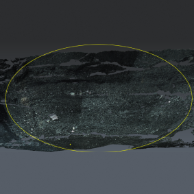
Surface with Low
Reflectivity

High Intensity Scan from
980 m (Reflectivity 8%)
Change Detection

Clean & Mesh Data –
1st Scan

Clean & Mesh Data –
2nd Scan

Combined Data –
1st & 2nd Scan

Equipment Locations
(1st & 2nd Scan)

Volume Calculation

Result

Deliverables

Point Cloud
(.e57/.rcp/.las)

Mesh
Model

Volume
Report

Cross
Sections

Contours

Cut & Fill
Analysis

Change
Detection

Stockpile
Summary

CAD / BIM
Models

Digital Twin
Industries We Serve

CONSTRUCTION & BIM
As-built documentation, clash detection, progress monitoring.

OIL & GAS PLANTS
Plant digitization, maintenance planning, shutdown projects.

MANUFACTURING &
AUTOMOTIVE
Factory layouts, digital twins, reverse engineering support.

INFRASTRUCTURE &
BRIDGES
Roads, bridges, railways, airports, metro projects.

HERITAGE DOCUMENTATION
Temples, forts, palaces, museums, cultural preservation.

MINING & QUARRY
Stockpile analysis, terrain modeling, site monitoring.

FACILITY MANAGEMENT
Building maintenance and asset management.

ARCHITECTURE &
SURVEYING
Existing conditions, renovation planning, site analysis.
Ready to Measure Your
Stockpiles with Confidence?
Get precise volume measurements and actionable insights
with our terrestrial LiDAR & SLAM solutions.
Frequently Asked Questions
1. Why is an As-Built Conditions Scanning is important?
It provides an accurate digital record of the current site, reducing design errors, construction clashes, and costly rework.
2. Which technology is best for As-Built Conditions Surveys?
The choice depends on your project. We may use Terrestrial LiDAR for high-accuracy industrial facilities, Mobile SLAM for rapid indoor mapping, Drone LiDAR for large outdoor sites, or combine multiple technologies.
3. Can you create BIM models from the survey?
Yes. We provide Scan to BIM, Revit models, IFC models, CAD drawings, Plant3D models, and Digital Twin deliverables.
4. Can surveys be performed while facilities are operational?
Yes. Many projects can be completed with minimal disruption to ongoing operations.
5. Do you provide surveys for heritage buildings?
Yes. We specialize in non-contact documentation of heritage structures, monuments, museums, and culturally significant sites.